


01
Emerald Peak | 2012-04-21
|
|
It has been in my to do list for a while, I was just waiting for an opportunity to try Emerald Peak since I saw TR from Nugara's website. Now that this peak is covered in his new snowshoeing book, I had to do it!
Before I start to trip report, I just want to mention, I struggled to come up with the proper rating for this summit. So rather than to just say advanced or any other rating as I normally do, I would say this summit is easy scramble in summer time. All you have to do is to use the big avalanche gully which I used partially on the way down from bottom to the summit. However in winter time, you want to stick with south ridge which will make this trip more difficult. Depending on amount and condition of snow on the summit ridge, this peak will be tiny bit sketchy.
Approach:
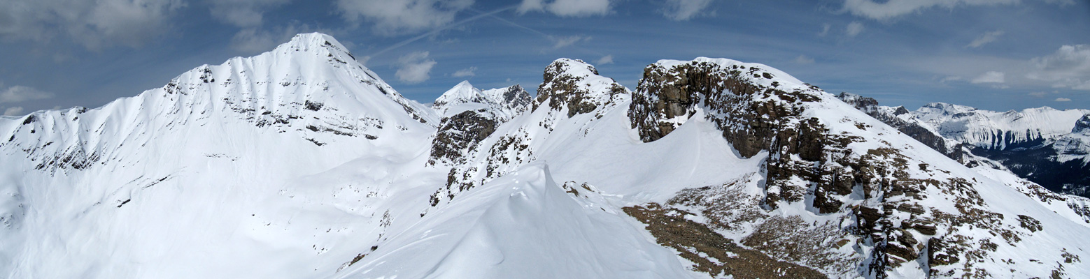
I followed Hamilton Lake Trail for about 3.5 km (GR303994) and went off-trail to get to the south ridge. Right after I went off-trail terrain got steep even for snowshoeing, but it only lasted for 50m and still some trees around which made me feel slightly safer. After this, terrain became flatter as I went up closer to treeline. Once at treeline, I could see false summit (page 3).
Summit Ridge:
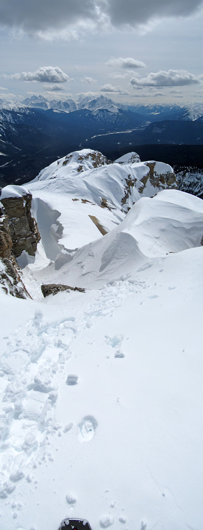
From the false summit things got more challenging (see page 7 & 9). In the snowshoeing book, Nugara says to go on to the first block and downclimb, instead I used snow feature which in the book says DANGEROUS AVALANCHE SLOPES!! Well you know me I don't read and my middle name is Danger. However this bypassed the downclimbing section.
Decent:
Don't follow my route. I didn't want to walk on the avalanche gully on alpine, so my plan was to go down the same way until treeline then traverse to the ava gully, but I didn't traverse far enough, I ended up light bushwhacking on steep slope. That was awful.


 SUBSCRIBE