01

Mount Coulthard | 2010-10-03

Mount Coulthard
  • Location: Crowsnest Pass
  • Activity: Bike-N-Hike
  • Height: 2,642 m (8,668 ft)
  • Elevation Gain: 1,400 m (4,593 ft)
  • Distance: 23.6 km / Round Trip (14.7 mi)
  • Avg Steepness: 6.8°
  • Estimated Time: 5-8 hrs
  • Technicality: Intermediate
  • Fitness Level: Hard

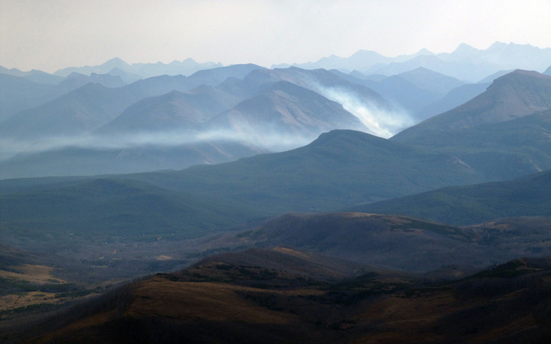
I believe Mount Coulthard is the last mountain in Crowsnest Pass which I have done in 90’ but not covered in my website. So I was pretty happy to complete the revisits of peaks in Crowsnest Pass.

Unlike Bob Spirko’s trip I decided to take bike approach for this one. Though I have to say much of the way up to Dakota plain crash site, I pushed my bike rather than riding… Shame on me!! Near the crash site, I found a spot to hide my bike and switched to hiking gear.

Route was quite simple. Go up along a long waterfall from the crash site (page 6). Then keep walking on toward south, you will soon find 2 of 3 almost identically tall peaks of Coulthard on left (east) (page 8). Go up the hill toward the peaks. The tricky part was not the route but finding out the actual summit. According to map, the peak should be most western peak (waypoint Peak 1) among the 3 peaks, however the tallest one is most eastern peak, the one Bob Spirko did (waypoint Mount Coulthard). After quickly summated closest two peaks (waypoint Peak 1 and Peak 2) I decided to ignore the true summit and went for somewhat isolated and lower peak (waypoint Peak 4) because I assumed the tallest peak is something else and not part of Coulthard. Once I looked back from Peak 4, I saw a trail leading to the summit, then I checked my GPS for Bob’s track only to realize that was where I was supposed to go lol (page 14). So I had to get back up again. If you go from Peak 1 → Peak 2 → Mount Coulthard → Peak 4 then you will save elevation loss and minimize distance unlike me. I was wondering and wandering without logistic. I went back the same way.

02

Mount Coulthard | 2010-10-03

Hummm. Not in my plan at all…

03

Mount Coulthard | 2010-10-03

Little history about the plain crash.

04

Mount Coulthard | 2010-10-03

The plain.

05

Mount Coulthard | 2010-10-03

Peeps graffiting.

06

Mount Coulthard | 2010-10-03

Waterfall. There was better trail on the right side.

07

Mount Coulthard | 2010-10-03

Would be a nice place to camp in summer time. Good water source. I think it's might be possible to do Andy Good Peak from here too.

08

Mount Coulthard | 2010-10-03

Peak 1 and 2.

09

Mount Coulthard | 2010-10-03

Andy Good Peak. It has been in my to do list for a year now.

10

Mount Coulthard | 2010-10-03

Smoke!

11

Mount Coulthard | 2010-10-03

When people talk about Crowsnest, they say Crowsnest Mountain, or Turtle Mountain (Frank Slide), but to me the height of Crowsnest belongs to Flathead Range which is this area. Mouseover for names.

12

Mount Coulthard | 2010-10-03

Peak 2 and True summit. Why did I skip the true summit? I must be dumb!

13

Mount Coulthard | 2010-10-03

One of my favorite places I have been. Andy Good Plateau. I camped the other side.

14

Mount Coulthard | 2010-10-03

Peak 1, 2 and the true summit. There was a trail leading to the summit… I checked my GPS and found out Bob Spirko's track went the same way as well. I have used his track too many times I know when he's track says so that means it's right. Oh crap I had to go back.

15

Mount Coulthard | 2010-10-03

Almost there.

16

Mount Coulthard | 2010-10-03

Another panorama of Flathead Range.

17

Mount Coulthard | 2010-10-03

Rainbow!!

18

Mount Coulthard | 2010-10-03

My dirty bike… Need bike wash.

RETURN TO TOP
 
CLICK BLANK SPACE OR PRESS ESCAPE TO EXIT