Helena Ridge to Stuart Knob
PAGE 1: HIDE PAGE 1SHOW/HIDE PIC 1SHOW/HIDE PIC 2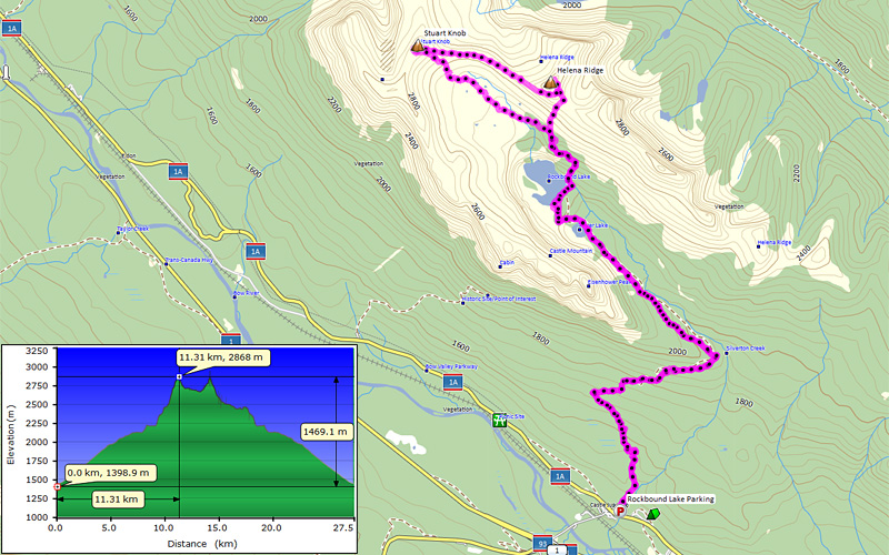

|
So a day after Elbow 4 peak traverse which was over 34 km / 2250 m, I went to Helena Ridge – Stuart Knob traverse which cracked 27.5 km / 1690 m…
To Rockbound Lake:
A long long boring journey… No view, no ambush from guerillas, no bikini girls, No nO NO NOTHING at all. It’s more like pain walking on the trail… Skiing down must be fun however.
To Helena Ridge:
There are few trails to get to upper flat of this uniquely shaped range, but probably we took the most used one. We followed a trail on lake shore on right side and found another trail going up a grassy/bushy slope. This trail led us at the bottom of a gully which goes to Helena (page 8).
To Stuart Knob:
We went back the same way until we were lower than cliff bands, then traversed south slope of Helena to connecting ridge. Rubble on the sidehill was very unpleasant and it was very hard to walk. It was one of these that size of rock didn’t matter. They were all hard and loose and rock falls can be triggered very easily. There might be a possible way to avoid this. I think there is a possibility that you can actually come down from east slope from the summit. This way you can minimize loose rock walk. See page 19 for high rez picture. You can easily get around rockbands except 1 rockband which I am not sure.
To the knob, we had to ascent similar hard and loose rubble slope… Snow made it little easier for us… The knob is sounded by rockband, so you need to go climber’s left (SW) to go around to the back side (page 26). Back side is just a rubble slope, you should be able to get to the summit block with no difficulty. The crux would be scrambling up this summit block. Just one move of moderate scrambling (page 27). By the way Gem Trek map is pointing the summit on wrong place. It is at GR724873.
Descent:
We followed a trail and went down to flat then find our way back to the gully we took to go up Helena. Then we returned to the never ending trail.
PAGE 2: HIDE PAGE 2SHOW/HIDE PIC 1
Eisenhower Peak from the bottom.
PAGE 3: HIDE PAGE 3SHOW/HIDE PIC 1
Σ( ̄ロ ̄lll)… My Hulk globes got some competition. Raff's Hellboy gloves!!
PAGE 4: HIDE PAGE 4SHOW/HIDE PIC 1
Long trail.
PAGE 5: HIDE PAGE 5SHOW/HIDE PIC 1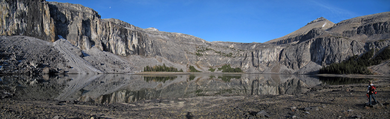
Rockbound Lake in the morning. It was very calm.
PAGE 6: HIDE PAGE 6SHOW/HIDE PIC 1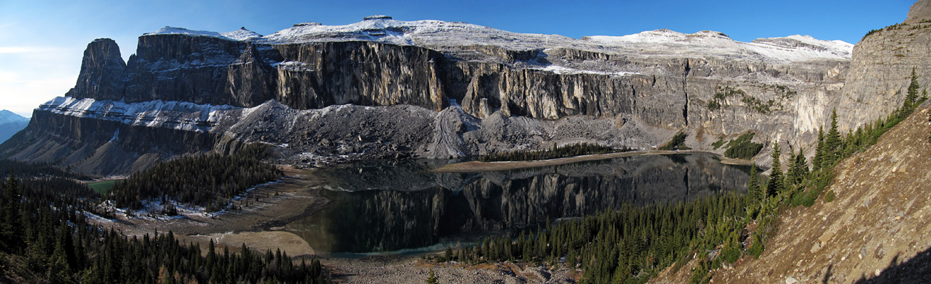
Views only get better from here.
PAGE 7: HIDE PAGE 7SHOW/HIDE PIC 1
|
|
PAGE 8: HIDE PAGE 8SHOW/HIDE PIC 1SHOW/HIDE PIC 2

Finally feels we got closer to Helena Ridge. Mouseover for route line.
PAGE 9: HIDE PAGE 9SHOW/HIDE PIC 1
Pano pano pano.
PAGE 10: HIDE PAGE 10SHOW/HIDE PIC 1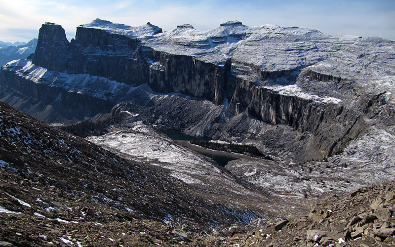
Truly how unique this mountain is.
PAGE 11: HIDE PAGE 11SHOW/HIDE PIC 1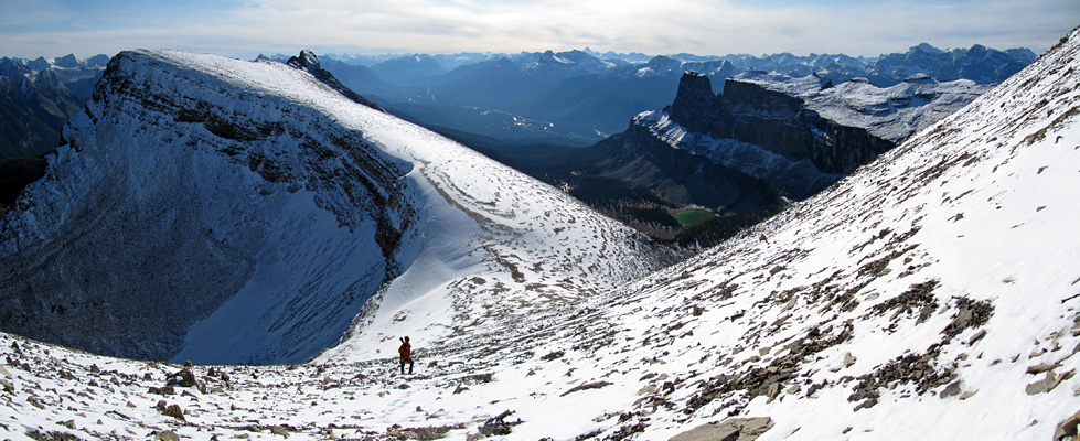
Long approach, slogging up rubble slopes… Remains me of Yesterday, Glasgow to Breast Banded Peak traverse…
PAGE 12: HIDE PAGE 12SHOW/HIDE PIC 1
At the false summit. Who bothered to build a cairn here?
PAGE 13: HIDE PAGE 13SHOW/HIDE PIC 1
Summit view!
PAGE 14: HIDE PAGE 14SHOW/HIDE PIC 1SHOW/HIDE PIC 2

Peaks near Lake Louise area. Mouseover for peak pointers.
PAGE 15: HIDE PAGE 15SHOW/HIDE PIC 1
Sphereshot of Castle Mountain.
PAGE 16: HIDE PAGE 16SHOW/HIDE PIC 1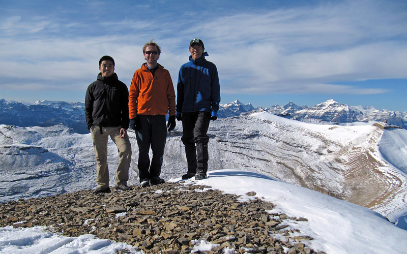
Group pic. From left, Greg, Raff, and me.
PAGE 17: HIDE PAGE 17SHOW/HIDE PIC 1
|
PAGE 18: HIDE PAGE 18SHOW/HIDE PIC 1
Almost near the end of horrible sidehill walk.
PAGE 19: HIDE PAGE 19SHOW/HIDE PIC 1
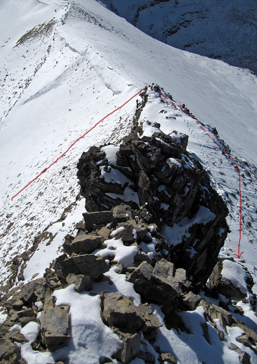
Looking back Helena Ridge. Click on magnifying glass icon to see zoom of Helena for possible althernate route.
PAGE 20: HIDE PAGE 20SHOW/HIDE PIC 1
Sauron watching over us… MR. FRODOooooo Do Something!!
PAGE 21: HIDE PAGE 21SHOW/HIDE PIC 1
More panorama…
PAGE 22: HIDE PAGE 22SHOW/HIDE PIC 1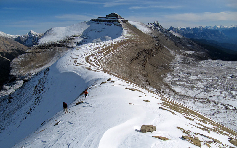
Snake shaped ridge. Cool!
PAGE 23: HIDE PAGE 23SHOW/HIDE PIC 1
I am getting hungry. What's my dinner?
PAGE 24: HIDE PAGE 24SHOW/HIDE PIC 1
I think I will eat dumplings. (* ̄ー ̄)_凸 I want rice too.
PAGE 25: HIDE PAGE 25SHOW/HIDE PIC 1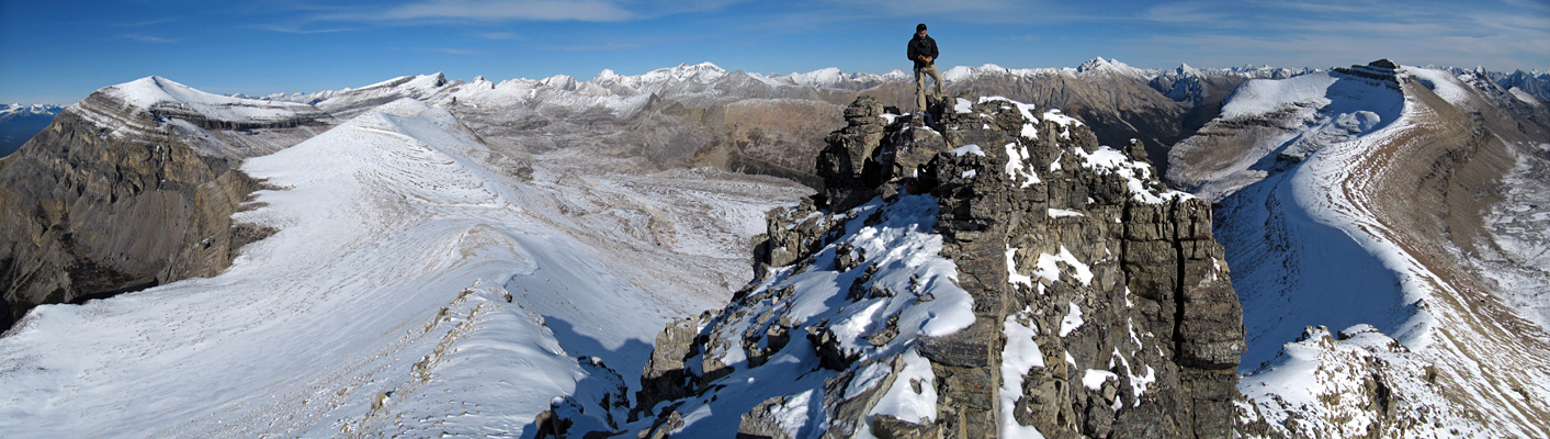
Greg at the summit.
PAGE 26: HIDE PAGE 26SHOW/HIDE PIC 1SHOW/HIDE PIC 2
Good picture to show the way around of rockband. Mouseover for line.
PAGE 27: HIDE PAGE 27SHOW/HIDE PIC 1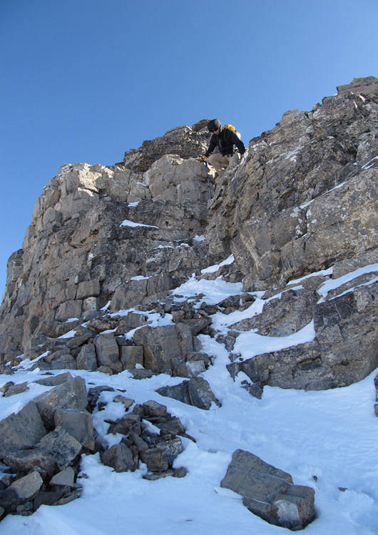
One short section of moderate scrambling.
PAGE 28: HIDE PAGE 28SHOW/HIDE PIC 1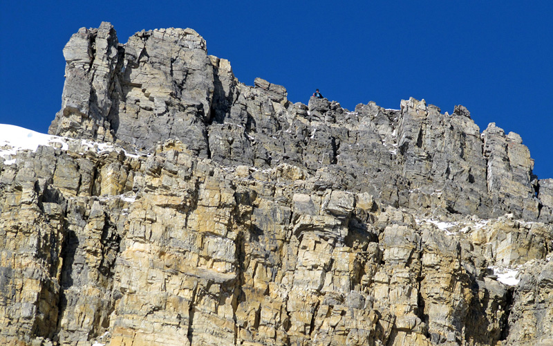
Sam at the top. I met Sam who I went to Smutwood with. What a coincidence.
PAGE 29: HIDE PAGE 29SHOW/HIDE PIC 1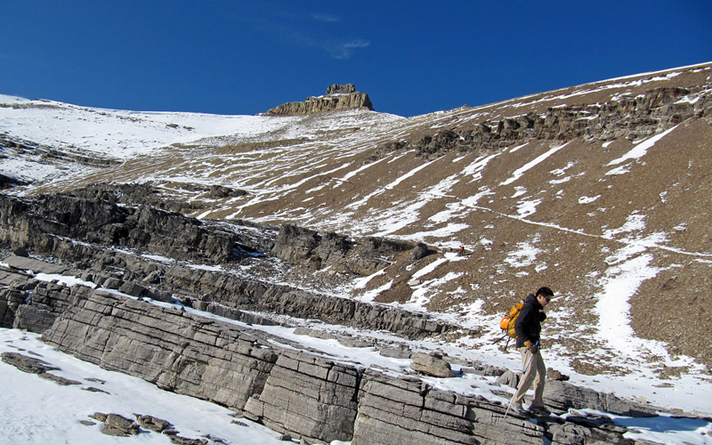
It was better to scree run than follow the trail for descent.
PAGE 30: HIDE PAGE 30SHOW/HIDE PIC 1
Long connecting ridge of Helena and Stuart.
PAGE 31: HIDE PAGE 31SHOW/HIDE PIC 1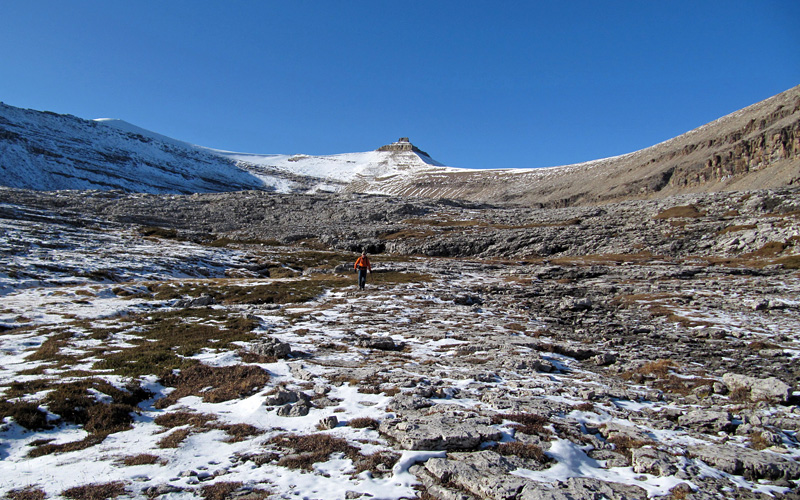
I don't want to walk that boring trail but I still like to come back here and have to come back here anyway for other peaks.