Storm Mountain (Banff)
PAGE 1: HIDE PAGE 1SHOW/HIDE PIC 1SHOW/HIDE PIC 2

|
|
By the way I argue why people refer this summit as Storm Banff? I think it should be Storm Kootenay. Only time you will be on Banff side is at the parking and at the summit. Rest of the day is in Kootenay…
Approach:
What a chaotic approach this was… First of all, I had no hope of finding trail under 20 cm of snow, so I didn’t bother look around. Second of all, dead falls dead falls dead falls, of course… I didn’t use the drainage but stayed higher up. By doing so I might have reduced dealing with dead falls for 3%. However it was true by staying off the drainage I didn’t have to walk on snow covered rocks. Walking on snow covered soil is so much easier for sure.
Ascent:
Slog up. That’s it. Slog up the west slope!! I took slightly different route than Kane’s route however. He’s route seems to take the second gully from left to get an open rubble flatter slope below summit in his picture. I took the most left which also was marked with cairns. My way didn’t require any scrambling. Coming up, my way looked more of straight line toward the ridge top (page 6). Then I traversed to the summit after getting top of the ridge.
PAGE 2: HIDE PAGE 2SHOW/HIDE PIC 1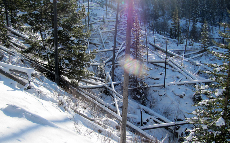
Talk about dead falls in this area…
PAGE 3: HIDE PAGE 3SHOW/HIDE PIC 1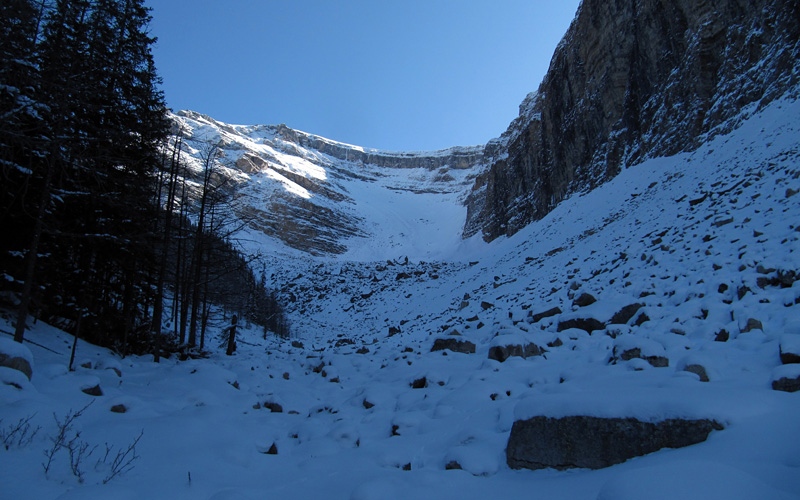
Here comes the cardio.
PAGE 4: HIDE PAGE 4SHOW/HIDE PIC 1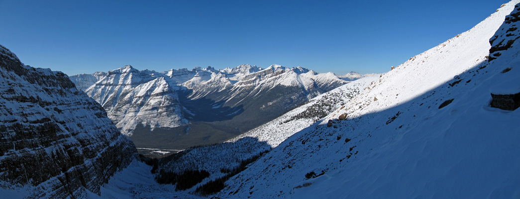
It took a long way to get out of shadow. Finally I was high enough to get sun light.
PAGE 5: HIDE PAGE 5SHOW/HIDE PIC 1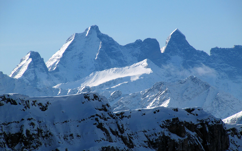
Goodsirs.
PAGE 6: HIDE PAGE 6SHOW/HIDE PIC 1
I have to admit it is getting harder to scramble… Snow season is almost here.
PAGE 7: HIDE PAGE 7SHOW/HIDE PIC 1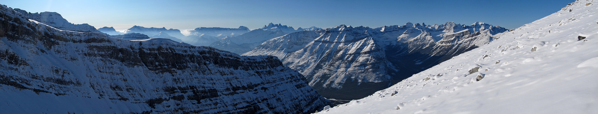
I wonder if the ridge route on left is possible. I have to say it would be far better and enjoyable route if so. More time with views, no hassle with rubbles and boulders. As far as I could tell once on the top of the ridge, it is hiking all the way to the summit.
PAGE 8: HIDE PAGE 8SHOW/HIDE PIC 1
Finally the summit in sight. Getting orange.
PAGE 9: HIDE PAGE 9SHOW/HIDE PIC 1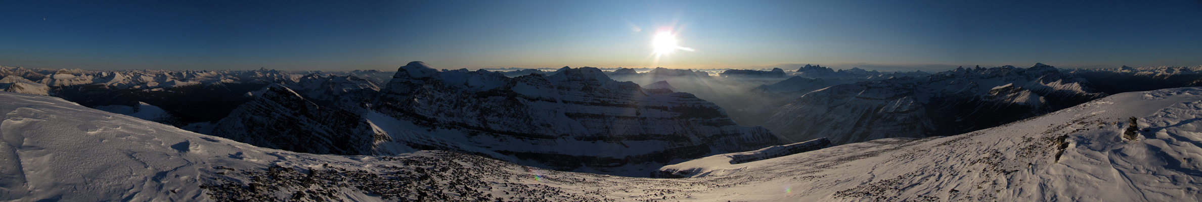
The summit view was awesome and time and weather played a good role on that.
PAGE 10: HIDE PAGE 10SHOW/HIDE PIC 1
East, the highway 1 side.
PAGE 11: HIDE PAGE 11SHOW/HIDE PIC 1
Very thin clouds around Rockwalls made it pretty.
PAGE 12: HIDE PAGE 12SHOW/HIDE PIC 1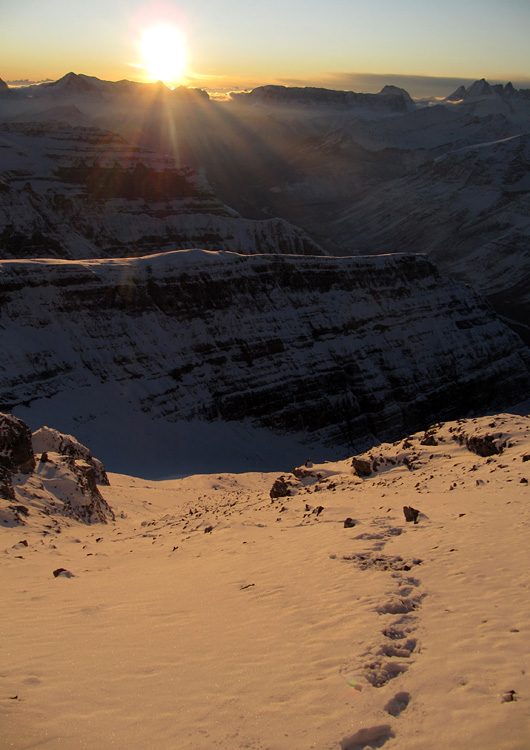
Time to go.
PAGE 13: HIDE PAGE 13SHOW/HIDE PIC 1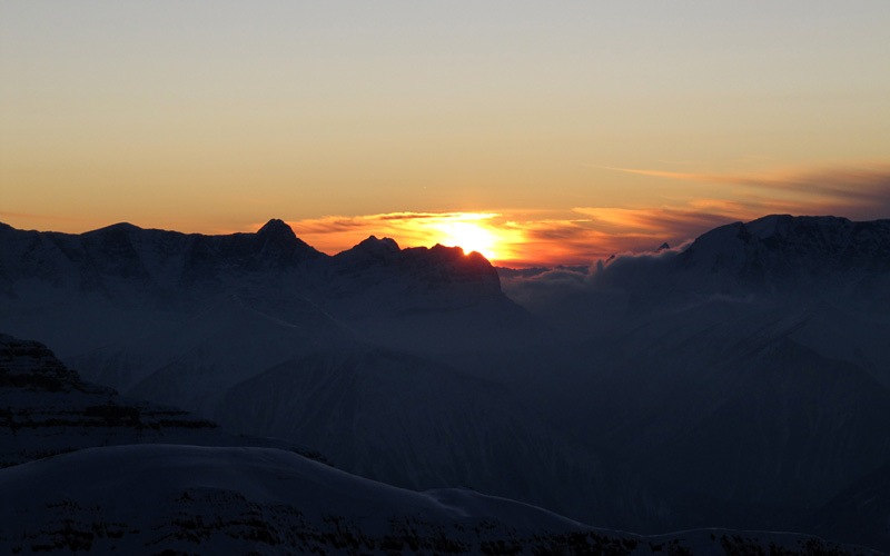
Sunset, the end of a beautiful day.
PAGE 14: HIDE PAGE 14SHOW/HIDE PIC 1
While I was descending, suddenly I realized something was lighting snow from behind. I looked back and there it was almost full moon. In the picture it looks full moon but it wasn't.
PAGE 15: HIDE PAGE 15SHOW/HIDE PIC 1
Sauron moon version. Mr. FRODO!!