Forum Peak to Akamina Ridge
PAGE 1: HIDE PAGE 1SHOW/HIDE PIC 1SHOW/HIDE PIC 2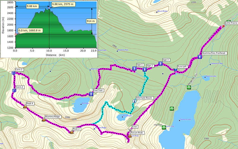

|
|
Just as I was looking for a long awesome winter scramble before we lose winter sense, Nugara posted his latest trip to Forum Peak on his website, and it grabbed me instantly. It was perfect because I could also visit my Canadian family in Crowsnest as well. I haven't seen them since last Christmas and it was time to get heck from mom... I thought I got rid of one from Japan... I guess I still have to deal with Canadian one... And yes my effort to visit them every weekend (since when?), my little niece finally recognized me.
I parked at Little Prairie parking as road was closed for winter. If you do this in summer you can park right at the Akamina Pass trailhead. The trail was well used and pounded that despite of fresh snow from night before, I didn't have to hustle to break trail. At wayponit "Turn Left" I got off from the trail and started bushwhacking. There should be a cut line to indicate AB/BC boundary but I didn't see it while I was on Akamina Pass Trail (page 3). But trees weren't dense and soon I came across the cut line. Once on cut line all you have to do is to stay on the cut line. It will lead to a steep hill which Nugara describes as "the big hill". After the hill, trees thin out and ridge becomes narrower and eventually ridge hits the crux, rock band (page 5 and 6). If you are not confident to scramble the crux, you can still take Forum Lake Trail which I marked as "Alternate Route". I have never taken this trail but according to map, this trail goes to the col between Akamina Ridge and Forum Peak.
There is nothing technical or navigation required once on the top of Forum Peak. The ridge is wide and hiking all the way to the other side of Akamina Ridge. Simply enjoy the view. Akamina Ridge has 3 notable peaks, center one being the highest, where I marked as "Akamina Ridge". Having said that, from Forum to waypoint "Peak 2" (page 15), it was icy and using crampons are recommended. At the end of the ridge, you will see a cairn (waypoint "Cairn 3") where descent begins. Descent route is avalanche terrain and I sew knocked down trees from the past as well as avalanche debris from this winter. (after waypoint "Cairn 3") Checking condition before your trip is highly recommended.
Once on the bottom, stay on trail and hike back to the parking lot. I am guessing in summer condition, you should not have problem finding Wall Lake Trail. Enjoy Akamina's cliff wall and Wall Lake on the way back.
PAGE 2: HIDE PAGE 2SHOW/HIDE PIC 1
Forum Peak and connecting ridge to Akamina Ridge from road. Actually the peak which appears as the highest point in this picture (right) is the second highest point of Akamina.
PAGE 3: HIDE PAGE 3SHOW/HIDE PIC 1
Cut line to indicate AB/BC boundary. Once get off from Akamina Pass Trail, stay on this cut line which will lead you to Forum's ridge.
PAGE 4: HIDE PAGE 4SHOW/HIDE PIC 1
Cameron Lake below and Mount Custer in USA.
PAGE 5: HIDE PAGE 5SHOW/HIDE PIC 1
The ridge became narrower as it got closer to the crux, the rock band.
PAGE 6: HIDE PAGE 6SHOW/HIDE PIC 1
There is disagreement between Kane and Nugara about this rock band. Kane rates this route as moderate while Nugara describes this crux as "some 5th class moves". (See Nugara's website) Both Nugara and I did this in winter condition and that made this scramble more difficult but still I don't think this rock band should be rated moderate. I spent probably 30 minutes trying to find a weakness and possible way up. I tried from center and failed. I went to the right and tried few times and finally I succeeded but if you see from previous page, right side is exposed and fall can be fatal. It was the time I wished I were a cartoon character. And I was dumb enough I didn't read whole thing from Nugara's website beforehand, the rock band was quite surprise for me. ( ̄_ ̄ i)
PAGE 7: HIDE PAGE 7SHOW/HIDE PIC 1
Lucky me. The first time since last fall, I brought my summer globes. The green monster, Hulk gloves!! Without them, I probably could not scramble up the crux.
PAGE 8: HIDE PAGE 8SHOW/HIDE PIC 1
After the crux there were more rocks but I went to the right and there was a nice easy crack which lead me to the summit.
PAGE 9: HIDE PAGE 9SHOW/HIDE PIC 1
Some serious cliff.
PAGE 10: HIDE PAGE 10SHOW/HIDE PIC 1
View from the summit of Forum Peak was superb.
PAGE 11: HIDE PAGE 11SHOW/HIDE PIC 1
Hairy zombie snowmen.
PAGE 12: HIDE PAGE 12SHOW/HIDE PIC 1
Interesting texture.
PAGE 13: HIDE PAGE 13SHOW/HIDE PIC 1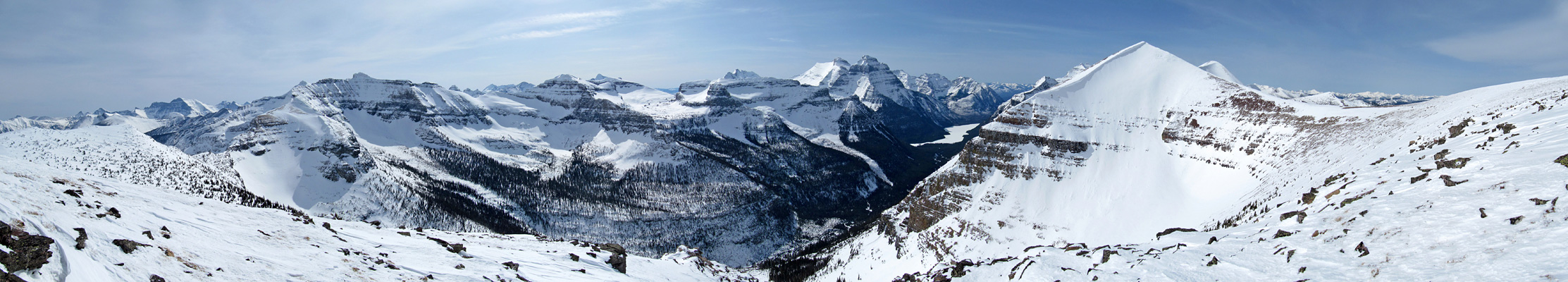
|
|
PAGE 14: HIDE PAGE 14SHOW/HIDE PIC 1
Akamina Ridge. Three peaks (from left) were the peaks I hiked staying on the official trail. Like Forum Peak, top of the ridge was easy but down below there was some serious cliff business going on.
PAGE 15: HIDE PAGE 15SHOW/HIDE PIC 1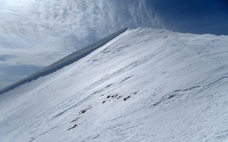
To the first major peak of Akamina Ridge.
PAGE 16: HIDE PAGE 16SHOW/HIDE PIC 1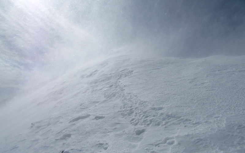
I was looking for a "winter" scramble and yes I got that, but I was only talking about snow and scenery wise, not -10° temperature and constant wild winds. Reminded me of hikes in last October and November… Well it's Waterton…
PAGE 17: HIDE PAGE 17SHOW/HIDE PIC 1
The long cornices hanging over east face of Akamina Ridge.
PAGE 18: HIDE PAGE 18SHOW/HIDE PIC 1SHOW/HIDE PIC 2

View from waypoint "Peak 2". After this ridge, there wasn't much snow. These bloody strong winds… Mouseover to see names.
PAGE 19: HIDE PAGE 19SHOW/HIDE PIC 1
From the highest point of Akamina Ridge. Looking down outlier and snow pit.
PAGE 20: HIDE PAGE 20SHOW/HIDE PIC 1
I don't know which mountain this is but this one really does stands out. Somewhere in BC far from Waterton. (I used x19 zoom)
PAGE 21: HIDE PAGE 21SHOW/HIDE PIC 1
North side of Akamina.
PAGE 22: HIDE PAGE 22SHOW/HIDE PIC 1
Going towards Wall Lake. I can't believe this didn't go over 10 hours and score Nugara trip. (I call anything longer than 10 hours as "Nugara trip") It took me 9.5 hours.